Tuesday, March 29, 2011

Farewell New Zealand

Fall has arrived. The peak of Mt. Aspiring is in the background.

Fall has come to the Southland. Although the days remain bright and warm, the evenings are becoming cool. Yesterday we awoke to find frost on the car. Time to move on.

We spent our last day in the Southland visiting a sheep farm. It seemed fitting since the industry has played such a large part in New Zealand’s history. It was a typical brilliant day with blue sky and sunshine sparkling off an early snow on the peaks. We travelled down Lake Wakatipu from Queenstown, via a steamship in continuous service since 1912, to Walter Peak High Country Farm - a working farm of 66 000 hectares and 22 000 sheep. There we learned about the industry past and present, marvelled as a working dog brought a flock down from the mountain then cut five sheep from the flock and drove them to a pen to be shorn. We watched as one was ‘fleeced’. After lingering on the deck of the original farmhouse drinking tea we boarded the late afternoon steamer for the trip back to Queenstown.


The TSS Earnslaw. In use since 1912
A top shearer can shear 200 sheep per day.


The next morning we flew to Auckland. The flight was a perfect way to return to where we had started ten weeks earlier. The flight path took us up the west coast of the South Island, past Mt.Cook radiant in the morning sun, over the Marlborough Sounds and Nelson, past Tongariro National Park and the three volcanic peaks and down into Auckland. In less than three hours we had retraced most of our journey from the air. It was a fitting farewell.

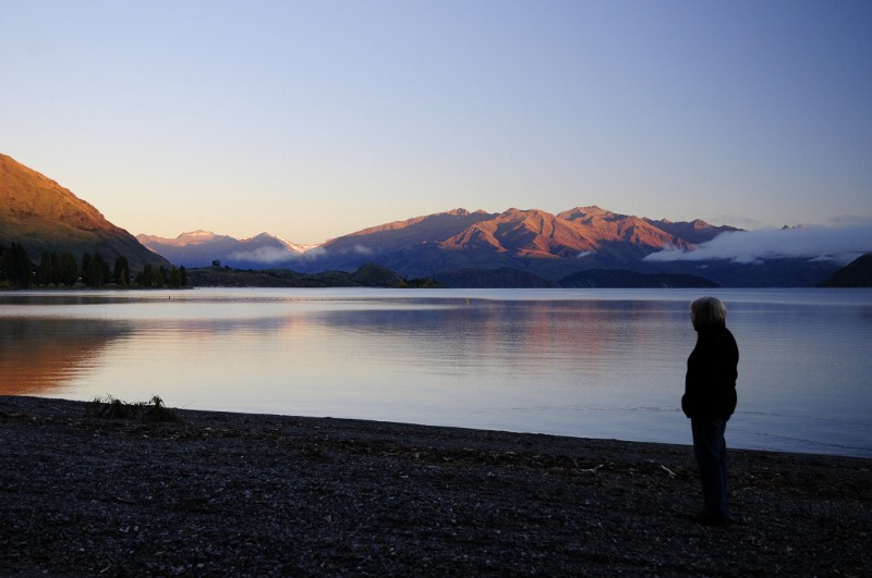
We will miss New Zealand. It has been a most amazing trip as we have tried to capture in our travel blog. The land is so new, so fresh and exciting. Humankind has inhabited New Zealand for about twelve hundred years, Europeans for little more than two hundred years. Shane Kozycan, the slam poet who recited at the closing ceremonies of the Olympics said “Canada is an experiment that is working.” So is New Zealand. There is a spirit which underlies the land that is tangible. People are proud of their country. They are easy in their own skin, friendly and very laid back. We were made welcome everywhere we went. I’m sure there are warts here somewhere. We just didn’t find them. It is a country well worth visiting.

We couldn’t agree what to highlight as part of our last entry so we each made some choices. Enjoy.

The drives Fran will miss:

The switchbacks on the West Coast

The switchbacks on the Crowne Ridge.
The switchbacks on Treble Cone. Yes, we drove to the top.

The waterfalls Ken will miss:


The signs we will miss:


What we will miss most:
Our daily "flat white".
See you all soon!

Wednesday, March 23, 2011

Milford Sound

Mitre Peak in Milford Sound.


Milford Sound is New Zealand’s most iconic destination. It is Number 1 on the “101 Things Each Kiwi Must See" list. When you get there, you understand why.

Part of the experience is the beautiful scenery leading into the sound. We drove down in a torrential downpour. We had been told that there is beauty to be seen in all weather and we were told correctly. Although the mountain peaks and the adjacent valleys were obscured, the rock walls of the valley through which we drove turned as black as onyx in the storm and the cascading rivers of rain were like veins of silver running through them. It was breathtaking.

We arrived at Milford Sound Lodge, our home for two days. The lodge is mainly a backpackers accommodation with bunk rooms and some private rooms. All bathroom facilities are shared, however. The  exception are four chalets recently opened to service the grey nomads. They are self-contained, with ensuite and overlooking the river. Fran booked ours last April. We were glad she did. As the rain continued to pour down, we settled into our cosy hide-a-way complete with burled wood cabinetry and radiant under-floor heating in the bathroom. We sat in front of the glass wall that was the front of our chalet and watched the swollen Cleddau River churn and race against it’s banks. Across the river dozens of waterfalls arched down the valley wall with such force they often did not touch the rock. As we sipped our wine and enjoyed the sheer force of the storm, as so often happens in this country, there was a sudden lull, a break in the clouds, a shaft of sunlight and the waterfalls were highlighted by a rainbow.


The rain stopped, the sun came out and there it was.
Fran enjoying morning coffee in our chalet.
Fran's morning view.

The next day was a mix of sun and cloud as we departed for our boat cruise. It is a great way to see the sound, second only to a helicopter flight. Part of our tour included the underwater observatory established to study the unique environment in Milford Sound. Since there is so much rain and the forest on the mountain sides can only absorb about ten per cent of what falls, there is a thick layer of mineral laden fresh water on top of the salt water. It blocks the sunlight, so a few metres down the light is similar to the light found at 60m depths. The result is an ecosystem usually found in deep ocean at a level of 10m. There is a public observatory at the 10m level. It is a fascinating experience.
Our cruise boat with Mt. Pembroke in the background.
Looking down the sound. It is actually a fjord, not a sound. It has been carved by glaciers, not eroded by a river.
White coral growing at about 10m.
Stirling Falls
Bowen Falls


It was a beautiful day.

Our final day was brilliant sunshine and intense blue sky. We had experienced it all. On the drive out we could see clearly the breathtaking beauty of the mountains and the valleys. A highlight is the Homer Tunnel. It is twelve hundred metres long and was dug by hand - pick and shovel - from 1935 until 1953. Heavy machinery was not used until the 1990’s when the entrances to the tunnel were widened. The pictures on display of the men working on this tunnel are amazing. In his teen years, Matt Groenig, the Canadian who created The Simpsons, was so inspired by the work done to build the tunnel, he named one of his main characters in honour of the tunnel. I just made that up.
The road leading from Milford Sound to Te Anau.
The wall at the end of the valley. No trick photography, this is a solid wall of rock.
The way through the wall - The Homer Tunnel. The entrance is in the centre bottom of the picture.
Some of the distracting views on the drive...
A section of the road can be seen at the V in the centre of the picture. That's where we are heading.
After three fabulous days we returned to our favourite village, Wanaka, for another week. Our original plan was to visit Christchurch, but those plans were changed after the earthquake.

Our plans to visit Australia have also changed. We have decided to return home on April 2 instead of May 2. Many factors have contributed to this decision. Two are Fran’s legs. The discomfort that she experienced a year ago has returned removing the enjoyment from walking. We are not disappointed, however,  to spend another week in New Zealand and to save Australia for its own adventure.

We plan to post one more blog before we leave.

Saturday, March 19, 2011

The Routeburn Trek

On route to the Routeburn Track trailhead. The snow covered mountain is Mt. Earnslaw.


Ken and Charles walked the Routeburn Track. It is a Great Walk of New Zealand and takes three days. The walk starts in Mt. Aspiring National Park and finishes in Fiordland National Park. It is three days of breath taking scenery - snow capped mountains, lakes, valleys, meadows and rain forest.


The first day of the walk is through beech forests. The elevation gain is about 600m over a 2.5km distance, so there is a lot of up. The reward is waiting at the Routeburn Falls hut. It is a beautiful structure set up on stilts to give commanding views of the valley below and the mountains above. We arrived to some fairly persistent cloud, so our views were restricted, but when the broke through - WOW.

The beech forests are also sub-tropical rainforests.
 We forded the river and headed towards the mountains.

The trail is well maintained and the views did break through.

Being a Great Walk, the trail is very well maintained and the sleeping huts are very comfortable. They have all recently been upgraded. NZ has discovered that their natural environment is a great tourist draw so they are doing a lot to make it inviting. The population of NZ is about 4 million and they attract 8 million tourists a year.


On the balcony of the Routeburn Falls hut. We came up from the valley seen over Ken's right shoulder.


Everyone gathers in the common kitchen/dining room to prepare and eat meals. It was fun to talk to hikers from all over the world. There is a great sense of fraternity. Hikers come in all shapes and sizes from muscular twenty somethings walking alone to groups of grey nomads and everything in between. The oldest hikers we met on this trip were in their early 70s. After a fantastic day we retired early - the power goes off at 10pm. I was asleep before I put my earplugs in. I woke in the morning with them still in my hand.

The next day starts with some serious up - about a 300m elevation gain in just over a km. That takes you to the high point on the hike, the Harris Saddle at 1260m. The middle day is the longest day between 5 and 6 hours of hiking depending on stops for photos and views. Unfortunately this day was the most overcast of our three so we had limited views. 


Nearing the top of the Routeburn Falls.
The trail takes a sharp left turn. Luckily the cloud had drifted away and we saw the sign. Beyond it is straight down.
Just to keep you on your toes...
...falling rock and the trail narrows
...and goes under an overhang.

 
Views did break through.

Another view peaking through.

Whereas the bunks at the Routeburn Falls Hut were 4 to a section - a small room without doors,  the bunks at the Lake Mackenzie Hut are 34 to a room.  I’ve noticed that no matter what language people speak they all snore the same! It was an interesting night since I somehow lost my earplugs.

The third day started with a modest elevation gain and then was a gradual downward slope to the end. We walked through a mixture of sun and cloud. 
It's all downhill from here.

Dropping below the clouds.
Lake Howden.
An hour from the end we stopped at the Lake Howden Hut to eat our lunch. Charles and I sat there feeling very satisfied with our accomplishment when a young man came bounding down the trail in shorts and running shoes. He had run the trail in three hours!! He owned a small company that drops hikers at the trailhead and then drives their cars to the end of the trail so they are there when they finish. He then runs back to get his own vehicle to drive home. While we were telling him how amazing that was, he somewhat dejectedly explained that in spite of all his training, the best he could do in the annual Routeburn Track run was third at 3 hours. The top two runners did it in 2:48 and 2:54 respectively.

I did not take a picture of this young man and I am trying to forget that I met him.


Tuesday, March 15, 2011

Wanaka

Our side of the bay looking north to Mt Alta with the Rob Roy glacier in the background.
We came down the wet coast and turned left at Haast. The road followed  the Haast River valley rising to the Haast Pass and then descended, following the Makarora River valley. We skirted the northern edge of Mount Aspiring National Park, which provided some inspiring views. Crossing through the mountains, we entered the rain shadow and sunlight - lots of sunlight.

Sunlight streamed down as we drove along the shore of turquoise-blue Lake Wanaka, crossed over to the shore of Lake Hawea, then swung south and arrived at Wanaka at the southern tip of Lake Wanaka. Wanaka is a small village of 7,000 wrapped around a bay.  Across the bay, to the north, there are views of the Minaret Peaks, Mt. Alta and on clear days, Mt. Aspiring. Looking north from our end of the bay we can see the Rob Roy glacier.
Our first view of Lake Wanaka

The slopes of Mt. Alta in the early morning sun.
Looking across the bay towards the town.


Queenstown is an hour away by car over the Crown Ridge. Here we are over the ridge and descending into town.

We are here for two weeks, already well into our second. We are in a lovely one bedroom condo on the ground floor with walk-outs to a patio and garden from both the living room and the bedroom. After being active tourists between Nelson and here, we are just relaxing and getting to know the town. The centre is a lovely 20 minute walk away through a park and along the lake. We have been here long enough to have found a favourite cafĂ© and to be recognized by some of the merchants. Once again we find our days filled with leisurely breakfasts on the patio, reading, walking into town, having coffee and talking to the locals. The toughest decision of the day is deciding what to have for dinner, buying it and bringing it home. Some mornings we get up and go down to the lake to watch the sunrise. We have found the air to be wonderfully clean and refreshing in New Zealand since it  has no heavy industry. The biggest polluters are cars, cows and sheep. Being surrounded by mountains, the air here is almost sweet.

Main Street, our little town, looking towards the lake.

Wanaka is also known for sports - wind surfing, hang gliding and sky diving. Maybe next year.

Morning coffee in the garden.


Watching the sunrise.

Charles and Linda joined us part way through the first week for a few days. On the weekend the town hosted the regional A and P, agricultural and pastoral show, the largest on the south island. It is very similar to country fairs at home. On Friday Fran and Linda took in the horse jumping competition, toured the craft exhibits and finished the day listening to the evening concerts.

The same weekend Ken and Charles left to hike the Routeburn Track. And that will be the focus of the next entry.